Your Cart is Empty
Free shipping on US orders $120 and up (restrictions apply)
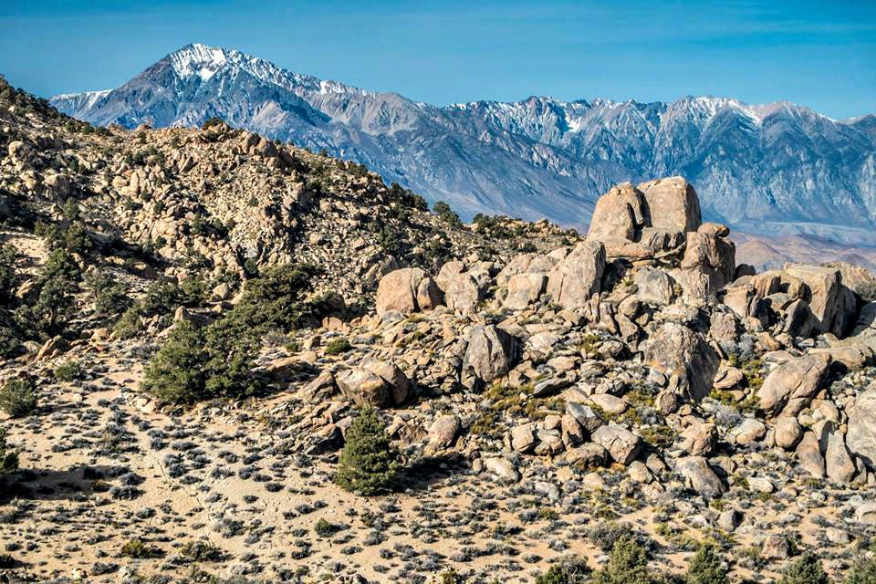
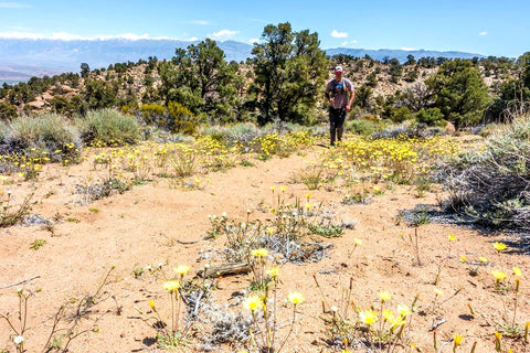
This 14-mile loop goes into the Coyote Mountain landscape from the valley floor and offers scenic views of Bishop and the Druids. A bit of a butt-kicker, too, this one will surely get you in shape for the High Sierra!
Distance: appx. 14 miles
Elevation Gain/Loss: appx. 3300’ (low point: 4250’; high point: 7550’)
Location: Bishop
Time of Year: highly variable for snow-free conditions in the upper part of the loop – April through October in an “average” precip year, year-round in very dry years
Directions From Bishop: head south on 395 and turn right onto Warm Springs Rd (dirt); you can park & start anywhere along this road which parallels the dump; not the most aesthetic of starting zones but it gets better fast! Route Description: This route links up 2 of the sweetest and steepest pieces of singletrack trail in the local frontcountry.
From start on Warm Springs Rd head uphill gradually on dirt roads to the Druid Trail trailhead. There is a maze of dirt roads in this area but basically, you just want to work your way up along the right side of the obvious ridgeline jutting out east into the valley (which you will be ascending on the Druid Trail). Pick up the Druid Trail and climb steeply to a fork in the trail just before a dip in the trail leading to the main Druid Stones. Take the right fork (unsigned) and continue up until the trail T’s with another trail, which is actually the trail you left down lower that goes past the Druid Stones and then ascends to the point you are now at more steeply (so you can go either way at that first fork). If you took the first right fork you will then be turning right here, or if you missed the first fork you will hit this same point and continue straight. Either way, you’re still going up. This intersection is at about 6900’. Continue ascending.
The trail will eventually dip down and in the bottom of that dip are the remains of a fence on the right. The trail then ascends steeply again briefly before coming into a fairly level area. About halfway through this level area, the Rawson Creek Tr comes in from the left. It is a hard left turn, unsigned, and fairly obscure. It is easy to miss. The turn is at 7500’. If you miss this and continue up you will eventually be right along Rawson Creek and will know you missed it. Once you make the left onto Rawson Creek Trail you are set. The trail is somewhat faint for a while before becoming a full-on trail. It winds around and slowly staircases down in elevation until about 6200’ where it bombs down in steep switchbacks to New Wilkerson, which you can now see. Turn left onto a dirt road before you get to the houses to work your way back the 3 or so miles to Warm Springs. You can either take the straightforward powerline road or take more secondary dirt roads in between the powerline road and the ridgeline for an electrical buzz-free experience.
Odds & Ends: Zero water on the route except for Rawson Creek which you come alongside briefly just above Wilkerson. Would definitely filter this low down on the creek. Great views of the jumbled mass of granite boulders and pinyon/juniper trees that is the Druids area. Long stretches of singletrack are few and far between in the frontcountry and the link up of these 2 trails rivals the Lower Rock Creek Trail for awesomeness. Unless you are part mountain goat you will be hiking a lot of the ascent. It is steep! Which is why I like to start down lower off Warm Springs Rd for a lower angle warmup.
Special thanks for Peter Clark for letting us use the great pics!
Comments will be approved before showing up.