Your Cart is Empty
Free shipping on US orders $120 and up (restrictions apply)
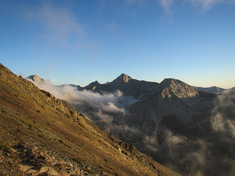
I only had 3 days, and was coming off of a nasty headcold, but I had been wanting to explore the Mineral King area, a strikingly beautiful and remote alpine corner of the southwestern Sierra that nearly went the way of "destination ski resort" development, since I had first heard about it decades ago; and I was tired of waiting. It was mid-September, which meant the weather window of opportunity could close on this backcountry foot-travel season at any time, thereby delaying exploration for yet another year. So, against better judgement in terms of kicking a cold to the curb, I loaded up my Ultimate Direction Fastpack 20 rig with 17 pounds of calories and gear and headed south for the trailhead outside of Lone Pine.
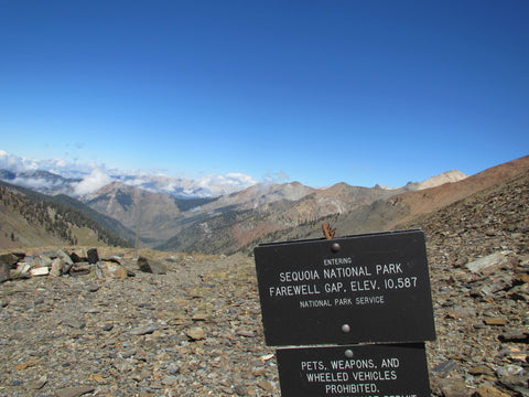
I hadn't even made my first trip to the Sierra when the Mineral King Valley was annexed into Sequoia National Park in 1978, protecting the area indefinitely and bringing closure to a long preservation battle that had the Sierra Club reversing its surprising position from pro-ski resort development to one of staunch opposition. Long before there was talk among the Walt Disney ranks of developing a massive 27-lift, hotel-heavy skier's paradise, there was "hopeful" silver and gold mining (hence the area's contemporary name). And, as is historical tradition in the Americas, long before that there were native tribes inhabiting the region as the original "discoverers" and trailblazers. Networks of singletrack trade routes across the Sierra connected the Yokut tribe of the Mineral King valley to the Paiutes of the Owens Valley to the east.
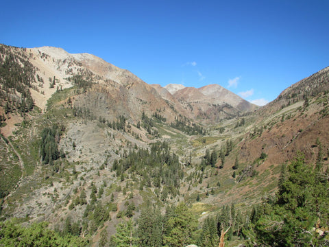
To pull off seeing Mineral King in person, without having to spend most of a day driving around the southern end of the range and another day driving back, would require 100 miles of trail; much more desirable though than several hundred miles of asphalt, I thought. My lingering congestion kept me from sleeping well and I jettisoned my alpine start plans for a 9am trail head departure that would become the nucleus of a snowball rolling towards a much longer 3rd day than I had planned.
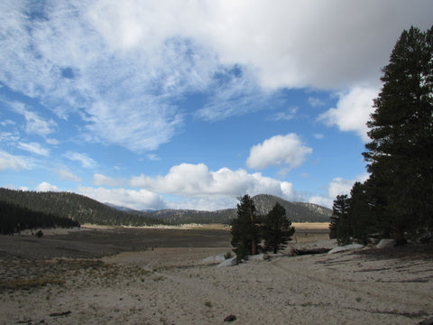
Trail Pass out of Horseshoe Meadow is barely a pass, a 600' bump to 10500' in what was otherwise a 20 mile flat and downhill stretch to the Kern River at 6200'. I doubt I would do this section again, at least not in the fall four years deep into a severe drought. There was a surprising amount of water along the way but this stretch is mostly travel through interconnected and massive meadows that were overgrazed to death many years ago, and volcanic terrain just to the north of Kern Peak. The trail amounted to the better part of 20 miles of beach sand, exhausting to the posterior kinetic chain and very challenging to make good time in. The sand was so pulverized and fine that, even with gaiters on, my Cascadias were constantly in need of being emptied to make room for my feet.
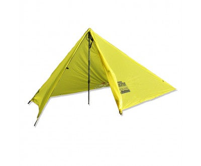
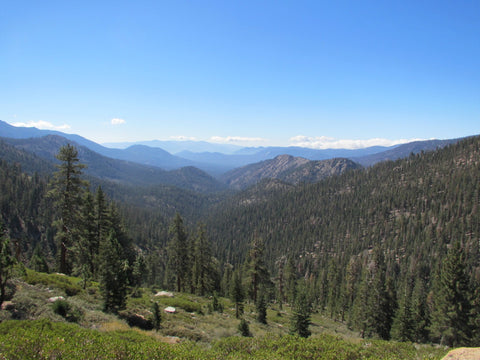
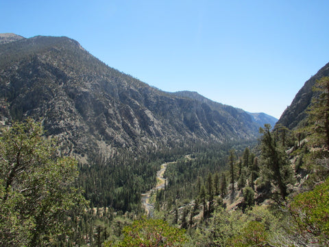
The feeling of unending-ness of this section immediately vanished as I plunged into the spectacular Kern River Canyon, crossing near a ranger cabin of craftsmanship quality. The ranger sitting on the porch reading in the early evening light had to be psyched. I know I was as I began the long grind back out of the river canyon up to 10200' Coyote Pass, where rapidly fading light and my late start conspired on a campsite several miles shy of the distance I had hoped to cover. The first cold front of the fall that had dropped a dusting of snow further north brought freezing temps and a blustery wind that blew relentlessly through the night. My CAMP Minima SL 1 tent kept me sheltered from the storm.
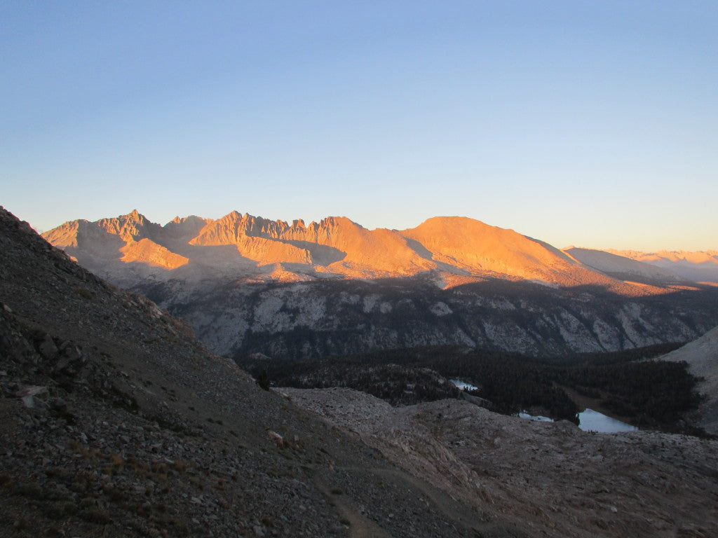
I packed up camp as quickly as frozen hands would allow and hurried off the pass under a pastel-hued sunrise, with stiff limbs resisting the need to move quickly immediately in order to generate some body heat. At a sun-warmed saddle several miles down the trail I stopped for a Jetboil-quick breakfast of oatmeal and coffee. I am not a fan of Starbucks coffee; my girlfriend calls it the "Folgers of gourmet coffee," and I have to agree, but their instant coffee Via packs combined with a Sugar In The Raw packet are worth their weight in gold in the backcountry to a morning caffeine-addict. I lingered at the saddle, staring across a massive expanse of the Sequoia National Forest that made me feel very far from my Eastside home. This would be the last time I didn't feel the pressure of being miles behind where I thought I'd be based on the itinerary pouring over Tom Harrison maps had generated.
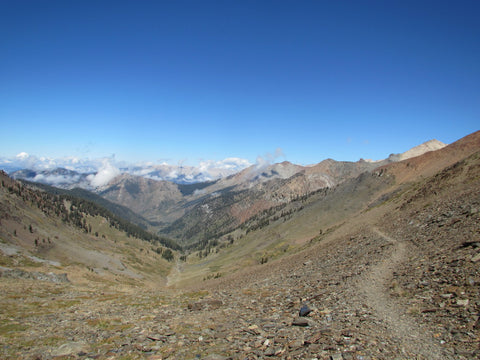
The trail quickly entered a burned area and became overgrown with post-fire invasives and difficult to follow at times. At a critical unsigned trail junction I pulled out the maps and turned right. I felt good about the decision until the trail fizzled out. Several more times I found the trail and lost it again. It was often faint, seemed little-traveled, and was obviously not maintained. Halfway up the drainage to an obvious saddle I stopped and pulled out the maps again. I didn't have a compass but could still more or less orient the map directionally. It sure seemed like I was going the right way. But the map showed a full-on trail. This felt more like a local wildlife corridor. I continued on, deciding that if the saddle did not reveal the Mineral King Valley on the other side I would simply have to cut my losses and turn back. I was already several miles behind schedule and these navigational monkeyshines were slowing me even more.
Darkness came quickly as I descended to the Little Five Lakes basin where I quickly set up camp, ate, and crawled into the claustrophobic confines of my tent. It IS ultralight, and it IS compact, but it IS also very light on space. You can forget about sitting up straight and clothing changes involve worm-like motions. Still, for shoulder-season fastpacking or when stormy weather is a good bet, it sure beats tarps and bivy sacks. Many will disagree with that. There is more than one way to travel light and fast in the mountains.
I was up and on the move in the pre-dawn darkness. Well, it would have been dark except the Petzl NAO headlamp I had impulsively bought after listening to one too many Trail Runner Nation podcasts in too short a period of time was illuminating my surroundings like stadium lighting.
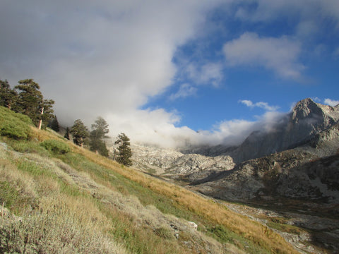
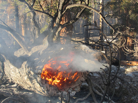
The sun and my eyelids had barely risen when I rounded a corner in the trail just beyond the lowest of the Big Five Lakes and found myself walking right into the still-burning remnants of a lightning strike fire started months earlier. Small pockets of smoke rose from burning logs and fallen trees. Pine needles and other forest floor cover burned casually in random arcs. I stepped off the trail into powdery ash to take a closer look at one of the fallen trees. The bottom near the stump had been hollowed out by the fire which still burned surprisingly vigorously inside, like a cranking wood stove. It was producing so much heat that I couldn't get very close. There were several of these scattered about. It was incredibly surreal. I thought back to the wind of two days ago and marveled at how long this thing had been smoldering without coming to destructive life. It would most likely smolder until winter.
Onward, I briefly descended into the Big Arroyo, climbed back out to drainage hop over to Rattlesnake Creek which rapidly dumped me into the Kern River Canyon. It was after 1pm and I had a marathon to go, only 10K of which held the promise of true running. Those 10K were the gently descending Kern River Trail to the posh, at least from the outside, ranger cabin. It was time to start running in earnest.

Of the many differences that distinguish fastpacking from traditional backpacking, this is a key one of them, one that allows you the possibility of covering so much more ground in a day, in a trip. Although it may not be particularly ideal to run with a pack of any weight on your shoulders, once you get light enough you can. The number will vary from person to person but for me, anything under 12-13 or so pounds and I'm good for periodic bouts of running, depending on the trail conditions. Get down around 10 pounds or less and it'll start to feel downright comfortable.
I don't remember what my pack weight was at this point in this trip but I turned that section of trail into the Kern River 10K, knowing the slog out of the canyon that awaited me. I wasn't looking forward to another 20 mile power struggle with the beach sand. At the bridge across the Kern I calorically-regrouped for the final push. Then, I found a suitable rock in the drought-tamed river, lay face down on my belly and drank heartily straight from the mighty Kern. Without the Lifestraw filter I now carry this would have been foolish. I don't normally filter water in the Sierra but I have always been very discrete about my sources. Unfiltered Kern this far down from the headwaters is miles from discrete. The Lifestraw made it an option; it has been a game changer in my backcountry hydration program.
To maintain my psych through the sand I decided to push hard and see just how close I could get to Trail Pass before needing artificial light. I stumbled by mostly starlight up the final switchback. When the wooden pass sign came into view I relented. A game within the game, within The Game. How many of these pointless and random games do we play with ourselves in a run, a fastpack, a work day, a year, a lifetime, in order to keep ourselves motivated and moving forward? If you're anything like me, far too many to keep track of.
As soon as the first bars of the outside world reached my phone on the drive out of Horseshoe Meadow, I pulled over to call my girlfriend. Then I called the Pizza Factory in Lone Pine and ordered up a large thick-crust grease-bomb. It was waiting when I arrived with the ravenous hunger that accompanies nearly every exit of the backcountry.
Chomping down on that first savory slice I robotically pulled out my smartphone and began constructing an Instagram post to share with a Facebook page and, just like that, less than an hour removed from one of the most-rewarding and mind-stilling fastpacks of the summer, of ever, my incessant like-loathe relationship with social media and the confusing and complicated modern world continued, unabated....
Comments will be approved before showing up.