Your Cart is Empty
Free shipping on US orders $120 and up (restrictions apply)
Two storms, both predicted to be very wet a week out, have now done the classic Sierra fall fizzle, leaving the southern half of the range high and dry, and ripe for late-season foot travel, whether it be a run, a fastpack, a mountain climb, or a combination of all three.
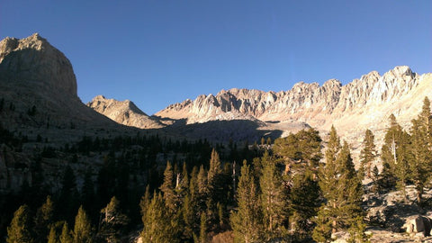
I was fortunate enough to spend 3 days in late October exploring Mitre Basin and climbing peaks in the area. To start day two I ascended Crabtree Pass before heading west on a traverse of the Mts. Newcomb and Chamberlain 3rd class ridgeline. It occurred to me though that descending Crabtree Pass to the upper reaches of the Crabtree Lakes and then traveling through that basin to connect with the Pacific Crest Trail and head back out over New Army Pass would make a great 3 day/2 night fastpack circuit from the Cottonwood Lakes Basin trailhead, combining a mix of trail and easy cross country travel (no greater than 2nd class difficulty).
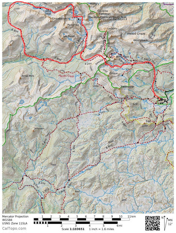
Here is the route description (the entire route is represented on the Tom Harrison 'Mt Whitney Zone' map):
approximately 45 miles total distance with about 33 trail miles and 12 cross country miles.
From the Cottonwood Lakes trailhead (not the Cottonwood Pass t/h) in Horseshoe Meadows at 10000' take the trail 8.8 miles to New Army Pass at 12300'. There are several trail junctions along the way. If you accidentally take a wrong turn and head through the Cottonwood Lakes drainage then you can simply continue up the trail over Old Army Pass which crosses the crest just north of New Army Pass and merges with the other trail just west of the crest.
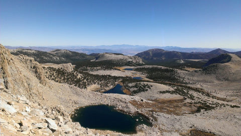
(If you're up for it the use trail for Mt Langley, the southernmost 14'er in the Sierra, heads up the south side of the peak from this vicinity. This is a "walk-up" 14er as long as you stay to the left (west) of the obvious cliff band that separates a lower sandy area from the summit plateau. The views are exquisite and you will get a glimpse into Mitre Basin.)
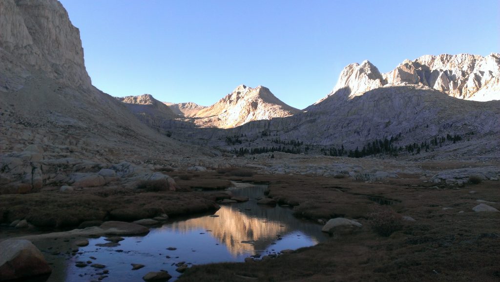
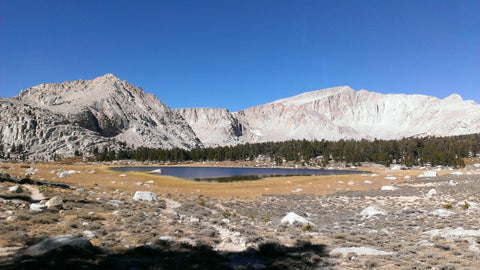
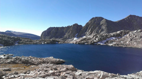
From New Army Pass descend down to 10700' in 3.1 miles and take the trail junction for Soldier Lakes. This is a good trail to the lower Soldier Lake which you will skirt on its west side. Here the trail turns into a use trail that ascends out of the Soldier Lakes drainage to the northwest, eventually disappearing altogether. The cross country travel is easy though. Contour along the forested ridge staying to the east of Rock Creek, which drains Mitre Basin. Eventually you will hit treeline and traverse open meadows and low angle granite slabs to Sky Blue Lake at 11545'. The lake is a great place to camp, or if you want a little tree cover, camp in the final sparse groves of pines about 300' below the lake.

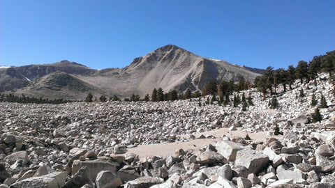
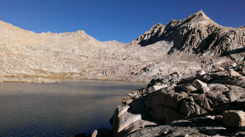
From Sky Blue Lake which is most easily passed on its eastern shore head almost due north to Lake 12129'. Between these two lakes you will have to navigate a cliff band, but if you stay way to the right and pick your way back and forth carefully you can keep it class 2 and chill. From Lake 12129' it is an easy walk up sandy/rocky slopes to Crabtree Pass at appx. 12500'. Imposing Mt McAdie rises to the NE and the long, convoluted ridgeline of Mt Newcomb ascends to the SW. From the pass you will need to carefully pick your way down a talus field to the uppermost Crabtree Lake. This is probably the crux of the cross country section but it is only steep for a short stretch. Once down to the lake you will simply follow Crabtree Creek through the drainage, passing two more large lakes and the superb granite lines of the towering N/NE walls of Mt Chamberlain. Crabtree Creek drains into the lower reaches of Crabtree Meadow at 10320' where you will intercept the Pacific Crest Trail.
Head south on the PCT over 10900' Guyot Pass and follow the trail as it bends east past the Rock Creek Ranger Station (not staffed this time of year). Just past the Rock Creek RS at 9800' you can either take the more direct trail past the Soldier Lakes junction and back over New Army Pass or continue on the PCT towards the Siberian Pass junction, then take a connector back north to the New Army Pass Trail. This would add-on maybe 2 miles but also add-in some trail variety.
This is just one option of many! The Southern and Central Sierra is essentially wide open as we head into the 2nd week of November. Get out and do something adventurous on foot! It will snow sooner or later and the trail running shoes will need to be swapped for skis in the backcountry...

Comments will be approved before showing up.